Hey all
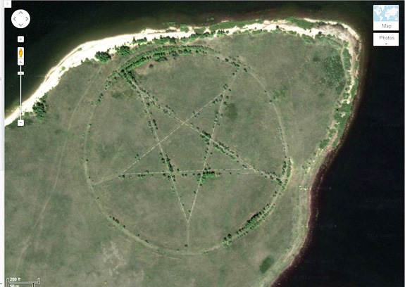
Just a few pics to get started, I'm sure there are tons more to find.
Are some of them staged because they saw the truck coming? Or is truth really stranger than fiction?
Odd pictures taken by Google Maps/Earth
These are apparently from Google Earth.
This kind of stuff fascinates me:
Nevada, USA (37.401573, -116.867808)
Nevada, USA (37.563936, -116.85123)
Nevada, USA (37.629562, -116.849556)
Red Sea Govenorate, Egypt (27°22’50.10″N, 33°37’54.62″E)
US Naval Base, Coronado, California, USA (32°40’34.19″N 117° 9’27.58″W)
Wittmann, Arizona, USA (33.747252, -112.633853)
kazakhstan
denver airport
Who is online
Users browsing this forum: No registered users and 185 guests